The train station was built in 1931 and it is huge and ornately decorated both inside and out.
One of the many outside fountains at the Milano train station.
The Cinque Terre is located in northern Italy on the Ligurian Sea.
The distance from Monterosso to Riomaggiore, in a straight line, is about 6.5 miles. However, by the hiking trails it is about 10.5 miles.
Arriving at Monterosso train station.
Clearly, many others have found the Cinque Terre! Our first view of Monterosso looking south. The weather for all 3 days was absolutely wonderful. The beaches were crowded like this all 3 days.
A view to the north, more crowded beaches.
After we checked in to our hotel, we decided to take the 1.5 hour hike from Monterosso to Vernazza. In her left hand Paula is holding the remnants of a cone with gelato. We had one to build up our strength for what turned out to be a very strenuous hike.
The beginning of the hike to Vernazza did not look hard at all. Nice wide path with an even surface. Little did we know what was ahead of us.
A view of the old town of Monterosso from the hiking trail.
This is where the hike started to get harder. After the hike, we found out that in addition to a change in elevation of over 800 feet, there were also 750 plus steps like the ones pictured here. Most of the trail was an uneven surface of rock winding through olive orchards and vineyards and offering dramatic views of the Ligurian Sea. In many places, we had to turn sideways, to let other hikers pass.
There are many vineyards located on the sides of the hills in the Cinque Terre region. On our hike we passed this vineyard. After they harvest the grapes, they put the containers in the machine to my right. It runs on a monorail which takes the containers to the area where they process the grapes.
As I reported earlier, the wine harvests in France and Switzerland, because of the damp cool weather, has been delayed until early to mid October. Here, because the weather has been much hotter and drier, the grape harvest was almost completed.
The most commonly grown white grapes grown in the Cinque Terre region are Bosco, Vermention and Albarola.
A view of the Ligurian Sea from the trail.
We have almost reached the top of the hill, prior to descending into Vernazza. We are very dirty and sweaty, but still smiling.
Our first view of Vernazza, a town virtually inaccessable by car.
Another view of Vernazza as we start the descent into town.
I am not sure if we were suppose to sample these grapes, but we did and they were delicious. At the end of the row of containers, was one container of purple grapes, they tasted even better than the green ones.
This area is know for producing very good white wines.
On a much sadder note. This is one of the houses that was destroyed during the Oct. 25, 2011 flood that hit the Cinque Terre area, The land was just washed away. There is no way they can re-build.
Another house that was destroyed by the floods.
The town of Vernazza, like most of the towns in the area is built near the Ligurian Sea at the bottom of step hills.
Here is part of a news report regarding the flood: On October 25, 2011, after a very dry summer, a freak rainstorm hit the Cinque Terre, an idyllic string of five Italian Riviera towns. Within four hours, the region got 22 inches of rain — a third of an average year's total. Because of the topography and the ability of the flash flooding to drain, three of the towns were undamaged, and two were devastated. Much of Monterosso and Vernazza were buried under four meters (almost 13 feet) of mud and left without water, electricity, or phone connections.
The destruction occurred mostly along former ravines, where,
historically, streams ran through the towns. In the last century, the ravines
were covered with roads, and the water drained through canals under the
pavement that, over time, were not properly maintained. Like congested arteries
(made even worse with all the debris that washed into town), the drainage
canals couldn't handle the raging flow, so the deluge went over ground. Trees,
furniture, cars, buses, and tons of mud and rocks plowed through both towns.
Water pressure from drain pipes below caused streets to explode upward.
Medieval wells in basements became geysers. Rivers of raging mud rampaged down
the streets, stranding people, and ultimately leaving shops and restaurants on
the main streets of old Monterosso and Vernazza buried.
This apartment house is uninhabitable. You can see how the land has just washed away.
This is a view of Via Roma, the main street of Vernazza
We visited the gift shop that is located just to the left of the stairs. As you can see, it was in really bad shape after the flood. The lady who owns the store told us that the interior of her shop was totally destroyed. The ceiling had collapsed, due to all the rain and mud, and then a lemon tree crashed through the ceiling and was setting in her shop.
A total of ten people were killed in the Cinque Terre region during the flood. One of the three people, who died in Vernazza, was found just outside her shop.
On a happier note, many of the houses have been repaired. Most of the hotels, restaurants and other businesses have re-opened. It is incredible how hard these people have worked to bring their town back to life, and they did it so quickly.
The Via Roma, today crowded with happy tourists. The restaurant where we ate lunch was packed, as were most of the other restaurants in town. It was a great site to see, after all the town has been through.
This church, dedicated to the patron of the town, Santa Margherita di Antiochia, was built in 1318. It was built in the typical Genoese Romanesque-style and what is most peculiar is that is has its foundations in the sea.
The small harbor in Vernazza.
Another view of the harbor.
We wanted to do more hiking, so we decide to take this boat to Riomaggiore and hike from there to Manarola.
A view leaving the dock at Vernazza.
A view of Corniglia (pronounced Cornelia) from the boat. You will notice, this is the only one of the five towns that was not built on the waterfront.
A view of Manarola from the boat.
A view of Riomaggiore as we enter their harbor.
A picture of one of the streets in Riomaggiore. The name Riomaggiore means "major river". It comes from the days when a major river ran through the village. This river has now been paved over and is the main street in the village.
The streets and alleys, pictured above, are typical in all of the Cinque Terre towns.
This sign points to the hiking trail to Manarola. Supposedly, a journalist, who noticed all the amorous graffiti along the path, coined the trail’s now-established name, Via dell’Amore: “Pathway of Love.”
In the fifties, this 600 foot long tunnel, which leads to the hiking trail to Manarola, was built next
to the railway lines. Later, a new concrete wall was build to protect the pedestrian
traffic. Around the year 2000, this footpath became a covered tunnel thanks to
the curved Plexiglas covering, fixed with steel ribs.
On the floor and sides of this 600 foot long tunnel, Argentinean artist, Silvio Benedetto, shaped and placed, by hand, thousands and thousands of pieces of stone, pebbles, marble, crystals, mirrors, shells, etc. to make all the different murals.
Along Via Dell' Amore is this bench, with a back in the shape of of a male and female locked in a kiss. As we walked along the trail we noticed padlocks attached to the railing behind the bench and also to the fences used to keep landslides at bay. Couples write their names on a padlock and close it together, tossing the key into the sea below, to symbolize their commitment to each other.
A sample of the "amorous graffiti" along the Via Dell' Amore.
Arriving at Manarola. It was getting late and we needed to catch the boat back to Monterosso, so we did not have any time to explore the village.
Sunset at Monterosso.
We are on our way to dinner and the end of a very long day. We had dinner at a restaurant called Il Casello, in "Old Town". We had a very friendly waitress. She spoke good English, but kept apologizing, for her "bad" English. She helped us order a great wine and terrific meals.
Paula had a Seafood Spaghetti and I had Trofie, which is a kind of pasta made from wheat flour and hand rolled into little squiggly shapes. It is one of the forefathers of modern and more sophisticated pasta. It was covered with their home made pesto sauce, which is made from basil leaves, extra virgin olive oil, grated cheese, pine nuts and marjoram - so very delicious!
The Cinque Terre region of Italy
is famous for many things, but as far as food goes, this area is known for its acciughe,
anchovies fresh from the sea, Limoncino, a desert wine made from local
lemons grown in the terraced orchards, olive oil from the many olive tree
groves around the area, and the ever popular homemade pesto.
Paula had anchovies at least twice during our stay. According to her, they were delicious. I had the homemade pesto at least three times, and could have had it a lot more if we had stayed longer.
Paula swimming in the Ligurian Sea. The water was warmer than the ocean at Cannon Beach, but colder than either Mexico or Hawaii.
The Ligurian Sea is extremely salty making it easy to have a relaxing float.
After a long and relaxing day at the beach, we decided to explore the old town of Monterosso before dinner.
Pictured above is a lookout tower which was built after a devastating pirate raid in 1545.
One of the remaining German "pillboxes" from World War II. During WW II, La Spezia, which is less than 18 miles from Monterosso, was an important Axis naval base and Monterosso was bombed many times, by the Allied forces, while the German's were here.
The Piazza Garibaldi. This piazza was named in honor of Giuseppe Garibaldi, a revolutionary who in 1870 helped unite the people of Italy into a modern nation.
One of the many small streets in Monterosso.
Oratory of the Dead. During the Counter-Reformation, the Catholic Church offset the rising influence of the Lutherans by creating brotherhoods of good works. These religious brotherhoods were called "confraternities". Monterosso had two, they were nicknamed White and Black. This building is the oratory of the Black group. Their mission was to arrange funerals and take care of widows, orphans and the shipwrecked. It dates from the 16th century and membership has passed from father to son for generations.
One of the many archways in Monterosso.
The Church of St. John the Baptist. The church was built in 1307. The front facade of the church is horizontal black and white marble stripes (the black stripes are actually aged green marble, they just look black). Above the door is a painting of John the Baptist baptising Jesus in the River Jordan (as you can see it is very weathered) and above this a beautiful rose window with twisted stone spokes, very typical of this region.
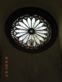
The Rose Window from inside the church.
Inside, the church is laid out like a basilica, with three naves. The central nave has a 17th century vaulted ceiling, but those of the side aisles have been restored to their 14th century appearance. The altar dates from around 1740 and its ornate Baroque style seems somewhat out of keeping with the more stark design of the church itself. Near the door (left-hand side as you enter the church) is a large stone font dating from 1360.
This is a picture of the interior of the church after the 2011 flood. During our visit, we met the parish priest. He provided us a lot of details about the flood. He said that there was 4 feet of water, mud and other debris covering the interior of the church. He was upset that the people who had been given stewardship over the land had treated it so badly. There is a large river that runs under Monterosso. According to the priest, they paved over the river in order to build streets. During the flood, the river under the town could not handle the volume of water, so it overflowed and flooded much of Monterosso. He said that if they had not pave over the river, the water would have flowed out to sea. causing a lot less damage. The church still shows a lot of damage, but it is amazing how quickly they repaired it in order to resume Mass.
During the November 1966 floods (the one that devastated much of Florence) this church had 3 feet of water inside. According to the priest, that flood was less destructive because it was mainly water, not the mud and other debris that accompanied the 2011 flood.
The Medieval Clock Tower of St. John the Baptist. It was built in the early part of the 1300's as a guard tower as part of the town's defence against marauding pirates.
Quite possibly the best restaurant in Monterosso or the whole Cinque Terre .
A melange of seafood served with eggplant. Fresh, local and perfecto
I had tuna steaks with balsamic reduction sauce
Live action food prep was going on all around us.
According to local legend, the town was originally settled by a Roman farmer who named it for his mother, Cornelia (this is how Corniglia is pronounced). The town and its ancient residents produced a wine so famous that "some" say that vases found at Pompeii touted its virtues. Regardless of the truth to the legend, wine remains Corniglia's lifeblood today.
The pathway from the train station, to the stairs, that leads up to the village.
There are 382 steps, like these, that must be climbed to reach the village. The village sits 300 feet above the Ligurian Sea.
Stairs leading to the top. Notice all the "switchbacks".
A view, looking south, from the stairs leading to the village.
We have finally reached the top.
Because the land is so steep, at least a 60% slope, the people had to build these rock wall terraces to grow their grapes. The terraces average about 10 feet wide and 3 to 6 feet high. The terrace system goes back in time at least a thousand years. On the hillsides there are terraces everywhere. It is estimated to have taken over 200 years to build the entire stone-walled terraces. We were told that in aggregate there are more miles of dry stacked rock walls creating the Cinque Terre terraces than there are in China’s Great Wall. It is hard to imagine that all the rocks were carried up by hand, no machines were involved, and then hand stacked to create the terraces.
One of the many small streets, common in the Cinque Terre villages.
A view of Corniglia.
The Church of St. Peter - the patron saint of Corniglia.
The church was built between 133 and 1351 using local sandstone. The roof edge is stylised like "saw teeth", held up by small hanging arches.
The rose window, built in 1351 in white Carrara marble, has been made with excellent workmanship and it has been conceived with elegance of forms. It has a very rich appearance with several different designs. In the central forum there is the figure of a deer - Corniglia's emblem.
We are starting the hike to Vernazza. The hike will take about 1.5 hours, but it is relatively easy.
During our stay we did 3 of the 4 hikes. The trail between Corniglia and Manarola is still closed, due to the landslides from the 2011 floods.
Along the trail we saw these nets rolled up under the olive trees. During the harvest season, they will unroll the nets and then shake the trees until the olives drop on to the nets.
A view of Corniglia from the trail to Vernazza.
A view of the Ligurian sea from the trail.
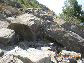
These are just some of the big rocks that come down the hillside during the flood. Fortunately, the rock slide did not do a significant amount of damage to this trail.
The Cinque Terre is quite dry. There are numerous cactus plants all over the hillsides.
Our first view of Vernazza.
This is how they get rocks up the hill, today, to repair the terraces and trails. It is a crawling type tractor with rubber treads, to protect the rock and brick on the trails. There were two men in front with a rope tied to the front end of the tractor, helping to pull it up he hill, as the engine was not powerful enough to do it .
We then took the train back to Monterosso as we had to end our stay and head back to Vevey. We really hated to leave Cinque Terre.
There are numerous train tunnels like this one all through the Cinque Terre region. Some are really long and some like this one, relatively short. We were told that during the bombings of La Spezia and Monterosso, the town people would take refuge in these tunnels until the bombings had stopped.


Thanks for sharing your experience, we are heading to the Cinque Terre in June. Would you say 3 days is enough?
ReplyDelete